
ʻEwa Beach, Hawaii
ʻEwa Beach, Hawaii
|
ʻEwa Beach
ʻEwa
|
|
|---|---|

Location in Honolulu County and the state of Hawaiʻi
|
|
| Coordinates:21°18′56″N 158°0′26″W[19] | |
| Country | |
| State | |
| County | |
| Area | |
| • Total | 1.9 sq mi (4.8 km2) |
| • Land | 1.4 sq mi (3.6 km2) |
| • Water | 0.5 sq mi (1.2 km2) |
| Elevation | 10 ft (3 m) |
| Population
(2010)
|
|
| • Total | 14,955 |
| • Density | 10,682.1/sq mi (4,172.7/km2) |
| Time zone | UTC-10 (Hawaii-Aleutian) |
| ZIP code |
96706
|
| Area code(s) | 808 |
| FIPS code | 15-07450 |
| GNIS feature ID | 0358767 |

Ewa Beach Park
ʻEwa Beach(/ɛvə/)[1]or simplyʻEwais acensus-designated place(CDP) located in ʻEwa District and the City & County of Honolulu along the leeward coast ofOʻahuin Hawaii. As of the 2010 Census, the CDP had a total population of 14,955. The U.S. postal code for ʻEwa Beach is 96706.
|
ʻEwa Beach
ʻEwa
|
|
|---|---|
|
Location in Honolulu County and the state of Hawaiʻi
|
|
| Coordinates:21°18′56″N 158°0′26″W[19] | |
| Country | |
| State | |
| County | |
| Area | |
| • Total | 1.9 sq mi (4.8 km2) |
| • Land | 1.4 sq mi (3.6 km2) |
| • Water | 0.5 sq mi (1.2 km2) |
| Elevation | 10 ft (3 m) |
| Population
(2010)
|
|
| • Total | 14,955 |
| • Density | 10,682.1/sq mi (4,172.7/km2) |
| Time zone | UTC-10 (Hawaii-Aleutian) |
| ZIP code |
96706
|
| Area code(s) | 808 |
| FIPS code | 15-07450 |
| GNIS feature ID | 0358767 |
History and etymology
The wordʻewameans “crooked” or “ill-fitting” in Hawaiian.[2]The name comes from the myth that the gods Kāne and Kanaloa threw a stone to determine the boundaries, but it was lost and later found at Pili o Kahe.[3]Hawaiian settlement on the ʻEwa Plain dates back at least to the 12th Century C.E., at which time Kanaka maoli expanded the main channel of Puʻuloa (Pearl Harbor) before creating fishponds and terraced agricultural fields in the surrounding area. Scholars have recognized ʻEwa’s ancient fishponds as exemplary evidence of Native Hawaiian ingenuity.[4]
Before Ewa Beach became a town it was first a huge plantation farm. With 11,000 acres (4,500 ha) of land sublet by Benjamin Dillingham, W.R. Lowrie became the first plantation manager in 1891, when Hawaiʻi was under the rule of Queen Liliʻuokalani.[5]Ewa Beach is significant for its association with Ewa Sugar Plantation. Throughout the twentieth century, it played a very influential role in Hawaii’s culture, economy, and politics.[6]
Along much of the South Shore ofOʻahu, ʻEwa is a reference to the direction of ʻEwa Beach, roughly westwards along the shore. Related terms are “mauka” (towards the mountains, roughly northwards), “makai” (towards the ocean, roughly South), and Diamond Head or Koko Head, roughly eastwards along the shore.
Geography
ʻEwa Beach is located at 21°18’56” North, 158°0’26” West.[7]The main thoroughfare is Fort Weaver Road (State Rte. 76) which runs north (away from the coast) past ʻEwa to Waipahu, connecting there to Farrington Highway (State Rte. 90) and the H-1 freeway.
According to theUnited States Census Bureau, the CDP has a total area of 1.9 square miles (4.9 km2), of which 1.4 square miles (3.6 km2) is land and 0.4 square miles (1.0 km2) is water. The total area is 24.06% water, consisting entirely of the Pacific Ocean off the island shore.
Climate
Demographics
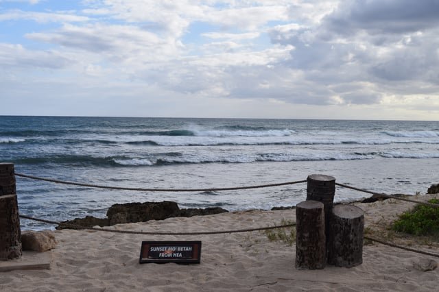
Ewa beach view to southwest
As of thecensus[11]of 2010, there were 14,955 people, 3,298 households, and 2,891 families residing in the CDP. Thepopulation densitywas 10,682.1 people per square mile (4,172.7/km²). There were 3,490 housing units at an average density of 2,492.8 per square mile (973.8/km²). The racial makeup of the CDP was 8.4% White, 0.7% African American, 0.1% Native American, 50.6% Asian, 12.9% Pacific Islander, 0.7% from other races, and 26.6% from two or more races. 11.1% of the population were Hispanic or Latino of any race.
There were 3,298 households out of which 50.8% had children under the age of 18 living with them, 62.8% weremarried couplesliving together, 17.5% had a female householder with no husband present, and 12.3% were non-families. 8.5% of all households were made up of individuals and 4.1% had someone living alone who was 65 years of age or older. The average household size was 4.50 and the average family size was 4.5.
In the CDP the population was spread out with 26.3% under the age of 18, 10.0% from 18 to 24, 24.1% from 25 to 44, 24.9% from 45 to 64, and 14.7% who were 65 years of age or older. The median age was 36.4 years. For every 100 females there were 97.9 males. For every 100 females age 18 and over, there were 96.1 males.
As of the 2000 census, the median income for a household in the CDP was $57,073, and the median income for a family was $58,104. Males had a median income of $29,512 versus $23,839 for females. The per capita income for the CDP was $14,807. 9.9% of the population and 8.5% of families were below the poverty line. Out of the total population, 12.4% of those under the age of 18 and 6.5% of those 65 and older were living below the poverty line.
Government and infrastructure
TheUnited States Postal Serviceoperates the ʻEwa Beach Post Office in ʻEwa Beach.[12]The Pacific Tsunami Warning Center is also headquartered here.
Education
‘Ewa Beach is served by the Hawai‘i Department of Education.
Little League World Series
In 2005, the team from ʻEwa Beach, representing (locally) West Oʻahu and the United States, captured the Little League World Series crown, beating Curaçao 7–6 in an extra inning after a walk-off home run by Michael Memea.[18]
References
[2]
Citation Linkopenlibrary.orgPukui, Mary Kawena; Elbert, Samuel H. (1986).Hawaiian Dictionary: Hawaiian-English, English-Hawaiian. University of Hawaii Press. p. 42. ISBN 978-0-8248-0703-0.
Sep 28, 2019, 10:49 PM
[4]
Citation Linkopenlibrary.orgJan Becket and Joseph Singer, eds.,Pana Oʻahu: Sacred Stones, Sacred Land(Honolulu: University of Hawaiʻi Press, 1999), 37.
Sep 28, 2019, 10:49 PM
[5]
Citation Linkwww2.hawaii.edu“Ewa Plantation Company”.University of Hawaii at Manoa. Hawaii Sugar Planters’ Association. October 10, 2012. Retrieved September 14, 2019.
Sep 28, 2019, 10:49 PM
[6]
Citation Linkhistorichawaii.orgHistoricHawaii (February 28, 2014). “91-1209 Alanui Mauka Street/Ewa Sugar Plantation Villages”.Historic Hawaii Foundation. Retrieved November 17, 2016.
Sep 28, 2019, 10:49 PM
[7]
Citation Linkgeonames.usgs.gov“‘Ewa Beach”.Geographic Names Information System. United States Geological Survey.
Sep 28, 2019, 10:49 PM
[8]
Citation Linkwww2.census.gov“Ewa Beach CDP Place Map” (PDF).census.gov. Retrieved November 29, 2011.
Sep 28, 2019, 10:49 PM
[9]
Citation Linkwww.zipdatamaps.com“Zip Code 96706, Ewa Beach, Hawaii Zip Code Boundary Map”.zipdatamaps.com. Retrieved November 30, 2018.
Sep 28, 2019, 10:49 PM
[10]
Citation Linkwww.weatherbase.com“Weatherbase: Historical Weather for ʻEwa Beach, Hawaii”. Weatherbase. 2011. Retrieved on November 24, 2011.
Sep 28, 2019, 10:49 PM
[11]
Citation Linkfactfinder2.census.gov“American FactFinder”. United States Census Bureau. Retrieved 2008-01-31. This article incorporates public domain material from websites or documents of the United States Government.
Sep 28, 2019, 10:49 PM
[12]
Citation Linkusps.whitepages.com“Post Office Location – EWA BEACH.” United States Postal Service. Retrieved on May 19, 2010.
Sep 28, 2019, 10:49 PM
[17]
Citation Linkfactfinder.census.gov“Ewa Beach CDP, Hawaii.”U.S. Census Bureau. Retrieved on May 21, 2009.
Sep 28, 2019, 10:49 PM
[18]
Citation Linksports.espn.go.com“Hawaiian Punch”. ESPN. August 28, 2005. Archived from the original on June 2, 2009. Retrieved July 19, 2009.
Sep 28, 2019, 10:49 PM
[23]
Citation Linkhistorichawaii.org“91-1209 Alanui Mauka Street/Ewa Sugar Plantation Villages”
Sep 28, 2019, 10:49 PM
[26]
Citation Linkwww.zipdatamaps.com“Zip Code 96706, Ewa Beach, Hawaii Zip Code Boundary Map”
Sep 28, 2019, 10:49 PM
[27]
Citation Linkwww.weatherbase.com“Weatherbase: Historical Weather for ʻEwa Beach, Hawaii”
Sep 28, 2019, 10:49 PM
[37]
Citation Linken.wikipedia.orgThe original version of this page is from Wikipedia, you can edit the page right here on Everipedia.Text is available under the Creative Commons Attribution-ShareAlike License.Additional terms may apply.See everipedia.org/everipedia-termsfor further details.Images/media credited individually (click the icon for details).
Sep 28, 2019, 10:49 PM